






Google pulls Earth AI tool after fake scenes floods the internet

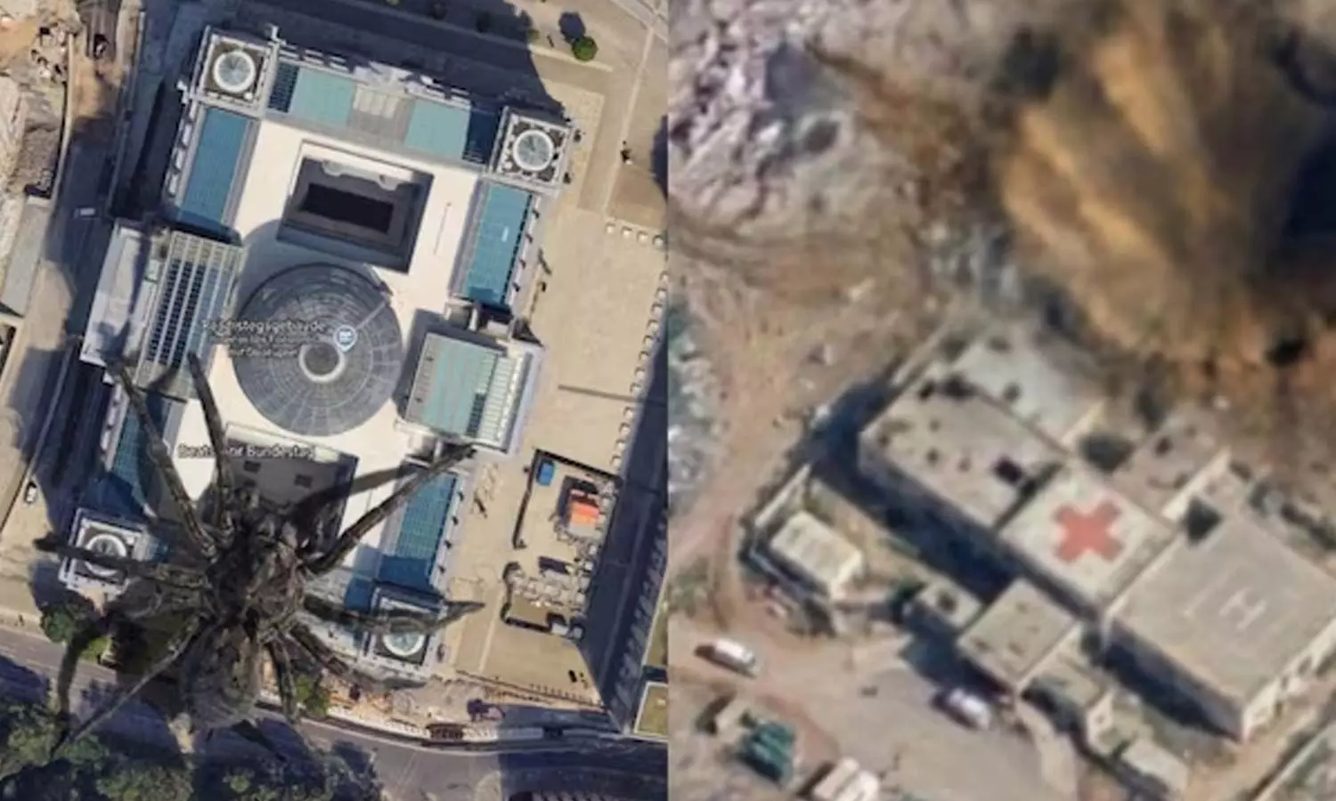
Google recently launched a new AI feature in Google Earth that allowed users to employ Gemini to create and modify satellite imagery. Within hours, the internet was flooded with images showing bomb craters in Gaza, plane crashes, and even a nuclear power plant in Iran. Google has since withdrawn the feature.
Google gave users the ability to alter the world's appearance using AI in Google Earth, and the result was exactly what one might expect: a total disaster. On Thursday, Google introduced "Nano Banana 2" to Google Earth, enabling users to create and modify satellite images. Although Google presented the tool as a way to reimagine the world or revisit history, the internet—as always—had a different perspective. Within hours, images appeared showing bombs falling in various parts of the world, floods, and even a nuclear power plant in Iran.
It is worth noting that this feature was available on the web version of Google Earth, a free platform offering 3D satellite imagery of the entire planet. With Nano Banana 2, it was possible to add elements or modify a location's appearance using a simple text prompt. For instance, one could transform their own neighbourhood into a sci-fi city.
Craters in Gaza, nuclear power plant in Iran
Giving the internet the power to modify the world's appearance was a risky move. Users did not hesitate to create photorealistic fake scenes capable of deceiving others online.
AI researcher Henk van Ess claimed to have used the tool to place a nuclear power plant in Iran and a hospital with a bomb crater in Gaza. Both scenes could have gone viral had anyone mistaken them for real images. Additionally, Henk showed a scene in which a crowd of refugees was flooding the U.S. Mexico border.
Van Ess stated that Google had spent 20 years building "the reference the world uses to cross-check information" and had now added "a button that makes things up."
Henk was not the only one. Since Google Earth is a free tool, anyone can create chaos with a simple prompt. For example, some images circulating on social media show a plane crashing into the World Trade Center in New York—a scene reminiscent of the September 11 attacks.
Why did Google withdraw this feature?
Google Earth is an important tool for researchers. It allows users to view satellite imagery from around the world and compare it with older images. For instance, it enables the observation of a city's urban development progress over the last 20 years. The tool is also used for open-source intelligence (OSINT).
However, if people were to flood the internet with fake scenes—especially of sensitive locations—it could wreak havoc online. Misinformation can spread very rapidly across the internet. Although Google assured users that AI-generated images would be verifiable via SynthID in Gemini, the company decided to suspend the feature for the time being.
"We know people rely on Google Earth for a trustworthy view of the world. We’ve seen geospatial professionals use this feature for various useful purposes; however, we’ve also seen people sharing screenshots of generated images that appear to violate our policies," the company stated on X. "As a result, we are removing this feature from Google Earth while we work on implementing more robust safeguards. It is worth noting that the generated images did not appear in the main Google Earth experience visible to other users and carried a watermark indicating they were created with AI."
Although SynthID can help detect AI-generated content produced by Google’s models, it is not infallible. In some instances, users found that images created via Nano Banana in Google Earth were not detected as AI-generated by Gemini.
NEET Paper Leak Fallout: Dharmendra Pradhan Steps Down as Education Minister, Says ‘I Never Shied Away From Responsibility’
AI Appreciation Day 2026: Trust and infrastructure emerge as the next frontier for AI, say experts
Few Takers for HILT Policy in Hyderabad Amid Low Response
Cockroach Janta Party Protest LIVE Updates: Demonstrators Assemble at Jantar Mantar
Fire breaks out at a building in Ameerpet of Hyderabad, fire brigade arrives
ED’s Vedanta raids raise questions about proportionality, perception


